Like a Swiss antique clock, the Land Registry in Switzerland is a complex and detailed system. Although it has many moving parts, it works like clockwork. Understanding how everything fits together is crucial to keep your property purchase moving forward without getting slowed down.
The Cadastral System is one of the most important aspects of the Swiss Land Registry system that you should know. This is a historical land surveying method that has been in use in Switzerland for many years. You may find it confusing at first, but it will become clearer once you understand its workings.
The system is exact, allowing landowners to quickly determine who owns a piece of property, its precise boundaries, and which laws and regulations apply to it.
This article will review the Swiss Land Registry by untangling its layers and presenting it straightforwardly. Our goal is to answer any questions you may have to understand the process thoroughly.
How Does the Swiss Land Registry Operate?
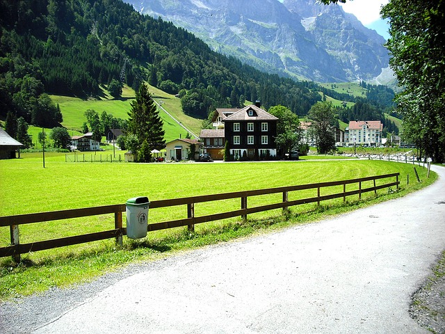
In Switzerland, every plot of land is recorded in the Swiss Land Registry.
It was created so that all land plots and landowners’ legal rights could be seen transparently and ensure that the real estate market is completely transparent.
In essence, every square inch of Swiss land has been surveyed and recorded in the Swiss Land Registry. Each plot is assigned to an owner and has a clearly defined boundary.
Switzerland is unique because it was one of the first countries to implement a system like this. As of 2014, the first records were posted online.
The Cadastral System: What does it do?
In Switzerland, the Cadastral System parcels up all the lands and ensures that they are mapped and recorded. Roads and public areas, for example, are recorded as belonging to federal, cantonal, or municipal agencies. Private businesses, cooperatives, or individuals own land parcels.
A parcel of land has a specific land ownership title registered with the public land registry. Land parcels are assigned a unique number, and all information about that parcel is associated with that number.
Cadastral surveyors collect very precise data based on heights and coordinates in the Swiss national survey. For all land surveys in Switzerland, there are control points that serve as references, ensuring consistency of records.
The legendary Swiss precision is applied to everything related to mapping and surveying.
It’s important to know this because Swiss property owners cannot simply do what they like with their properties. As a Swiss property owner, you must comply with specific conditions and restrictions, such as building zones that specify what can be done with the plot of land.
In addition, you should be aware of protected sites, groundwater protection issues, layout plans that limit building designs, etc. The precision of this system appeals to landowners as it eliminates confusion and ambiguity.
Why Does Cadastral System Exist?
The Swiss Land Register serves two primary purposes:
· Registration of property ownership.
· Display of information about properties and their owners.
In essence, the system is meant to protect land ownership. Geometric data collected during a survey leaves no room for error. By making this information public, every plot of land in Switzerland can be easily understood and legally enforced.
However, the Swiss cadastral survey system is not only used for determining land boundaries and identifying property owners. There are many other uses for it, both private and professional.
What is the evolution of the cadastre?
Cadastres were already established in Switzerland before Christianity to collect taxes on land ownership. The mid-17th century also saw the development of several large-scale plans for calculating tithes and payments.
Early in the 19th century, Switzerland introduced its cadastral system under the influence of Napoleon. Since 1912, the Swiss Federal Land Registry has recorded all official land ownership information throughout the country.
Before this, some surveys had been conducted in the cantons, but they were often uncoordinated and isolated. Surveying became legally official in 1919 after essential instructions were introduced to improve the surveying method.
The surveying methods have been improved ever since to become more and more accurate. New technologies are incorporated into the system as they arise. In 1993, new legislation was adopted which defined the digital format of cadastral surveying.
Since land surveying is now done digitally, it can also serve as the foundation for land information systems. As technology advances, the quality of the data collected improves, and the purposes for which it can be used increase. In today’s world, records are easily accessible online after only a few clicks.
The Cadastral System: How Does It Work?
Switzerland is divided into 26 different cantons.
The government is responsible for the Swiss cadastral system, the cantons themselves are accountable for the operational management, and the majority of the actual surveying is done by private firms.
Here’s an overview of how the system works on three different levels:
1. Federal (approximately 15 employees)
What is the Federal Directorate for Cadastral Surveying responsible for? There are about 15 employees at the federal level who are responsible for strategic planning and supervision. In addition to supervising the cantonal surveying agencies, they define the minimum requirements for administration, data quality, and processes.
2. (Cantonal Level) Approximately 210 employees.
Switzerland has 26 cantons. The surveying agencies implement cadastral surveying at the cantonal level.
While some cantons have their administrative units tasked with surveying, most outsource it to private land surveying firms. These offices deal with private land surveying companies as public agents for the cantons.
By putting the information at the public’s disposal via the geoportal, cantons receive information from private land surveying offices.
3. Local Level – Approximate 2.820 employees
Land surveying is done at the municipal or community level by private surveying offices, and the work of these offices constitutes approximately 90% of all cadastral surveying in Switzerland. In Switzerland, only registered surveyors are allowed to perform cadastral surveys.
There is a system established whereby the private sector is contracted for projects through a tendering process. On the government’s behalf, bids on the projects are invited, and private sector offices submit their proposals. In this way, the private surveyors act as agents for the public, providing a decentralized service.
Buildings and roads are constantly being constructed in Switzerland, so surveying land is never-ending. Continually, cadastral land surveyors measure the changes in the landscape caused by human activity (such as the construction of a new building).
The canton may also update the maps periodically when natural changes occur, for example, when the perimeter of the forest changes (which costs money to the canton).
Why is the cadastral system organized in this manner?
Why do private land surveying firms bid on municipal projects? Having the system set up in this manner creates competition for the private land surveying offices, which is a significant benefit.
To stay competitive, providers in the private sector must constantly improve their systems and learn new technologies and processes.
The system is also set up this way so that information about the public-law restrictions associated with a given parcel of land can be obtained more easily. Each canton is responsible for publishing its records via the geo-portal, so the system allows easy public access to all of this information, which can be accessed anytime in digital form.
Can I know the Value and Benefits of Cadastral Surveying?
Why is this system necessary? Which benefits does it provide? There are a lot of them.
Cadastral systems were only used concerning the land register when they were first established. It has, however, evolved and has benefited many other areas of Swiss public and private life as well.
Legal security is one of the main benefits of cadastral surveying. Due to these highly detailed maps, it is abundantly clear where one landowner’s property ends, and another begins. Identifying the exact location and dimensions of the plot in the land register ensures there is no confusion or dispute.
The cadastral system also benefits the national economy by providing detailed and reliable information. By collecting geographic data, these surveyors create an accurate map of the country, including farmland, lakes, roads, rivers, railroads, etc. Various initiatives can use this information, including construction planning, navigation systems, and tourist information. With reliable and accurate data, engineers and architects can base their plans.
This system is also beneficial for urban growth. A spatial plan is needed when a municipality plans a development, such as a train or a tram route, a traffic solution, an application that displays disabled parking spaces, or a district heating system. For these innovations, the cadastral system provides incredibly valuable data.
The cadastral system even benefits farmers. The GNSS (Global Navigation Satellite System) can be used to optimize seed, fertilizer, and pesticide application.
In the process of recording and documenting property boundaries across Switzerland, the cadastral system contributes to the prosperity of the economy and the well-being of the country.
How Does This Affect Swiss Land Owners?
The Swiss Land Registry System provides landowners security. By purchasing a house and applying for a mortgage loan in Switzerland, you’ll ensure that your loan is secured by equivalent collateral. All maps and entries in the land register will be legally binding.
Land purchases in Switzerland are therefore secure, verified investments.
Therefore, if there are any regulations or restrictions on your land, you can get a clear answer quickly and easily. The web portal will display all public-law restrictions on land ownership in an easy-to-understand map and provide access to geo-data.
You can also print a static extract from the map as a PDF containing all of the restrictions applicable to a particular plot of land. Unless otherwise stipulated, these PDF documents are official and can be notarized.
With just a few clicks, you’ll be able to verify whether any public law restrictions apply to a plot of land before purchasing it.
How do I register a property with the Swiss Land Register?
Land registers are required for every single property in Switzerland. A notarised sale-purchase contract must accompany it. Following the signing of a sale-purchase contract, the Swiss Land Register must be notified, and the transfer of ownership must be recorded after the transfer of funds.
Typical Grundbuchauszug (Land Register Record): How Does It Look?
A typical Land Register Record includes the name of the corporation or private individual who currently (at the date it was issued) owns the land. Only one specific plot of land is associated with this detailed record, which cannot be changed or added to.
Q&A
1. Do foreigners have restrictions on what properties they can buy?
Switzerland permits foreign citizens to buy property under certain conditions, such as living there for at least 6 months before buying.
2. How do property taxes work in Switzerland?
Switzerland taxes foreign property owners at three different levels: the Federal Government, the Canton, and the Commune.
You can choose from two possibilities – either you will complete a tax declaration that discloses all of your assets regardless of the country they are located, or you will be assessed on the fiscal value of your Swiss property. Most people choose the latter option.
Property taxes are calculated based on the theoretical rent you could derive from your property. Property taxes are based on the tax value of the property.
3. Are there any taxes on the resale of property?
As a foreigner, you will have to pay an appreciation tax if you resell the property in Switzerland. These are taxes based on the difference between the sales and purchase prices, including extra renovations, improvements, or fees. It is possible to deduct real estate commissions and other costs from this tax.
The capital gains tax rate decreases with each passing year. You will pay less resale tax the longer you own your property. Within the first year, you will have to pay 30%. Nevertheless, you will only pay 9% if you sell after 10 years and 1% if you sell after 25 years.
4. Does the purchase of a property include any other fees or costs?
Purchasing a home comes with a couple of extra fees. Among them are:
· Notary Fees: Swiss notary fees are relatively inexpensive compared to other countries in Europe. Fees will vary depending on the canton, but they are usually between 2.5 and 5% of the purchase price.
· Mortgage registration fees: Fees for mortgage registration vary from canton to canton, ranging from 0.6% to 1.6%. If buying a resale property, you might avoid the charge by taking over the existing mortgage deed.
Conclusion
Although the Swiss Land Registry appears complex at first, it’s a very lovely system. It has many moving parts that work in conjunction in an ingenious way to keep ticking along. It provides accurate, specific, and reliable data because all parties involved are committed to excellence.
Using this example of Swiss precision, the adage “everything in its place” is reflected. When this system is fully implemented, there is no area of forest, farmland, road, or apartment complex that is not clearly defined.
With the cadastral survey information available online in an easily accessible way, it is possible to search for any property and immediately know who owns it, the exact boundaries, what public-law restrictions apply to it, and other important information.
This is extremely valuable in the real estate industry for many reasons, including market transparency and legal issues.